BSU Studies Coastal Areas of Samur-Devechi District Using GIS Technology
A scientific seminar titled "Analysis of the Influence of Natural and Anthropogenic Factors on the Transformation of Landscape Types in the Coastal Areas of the Samur-Devechi Physical-Geographical Region Using Geographic Information Systems (GIS)" was held at the Faculty of Geography, Baku State University (BSU).
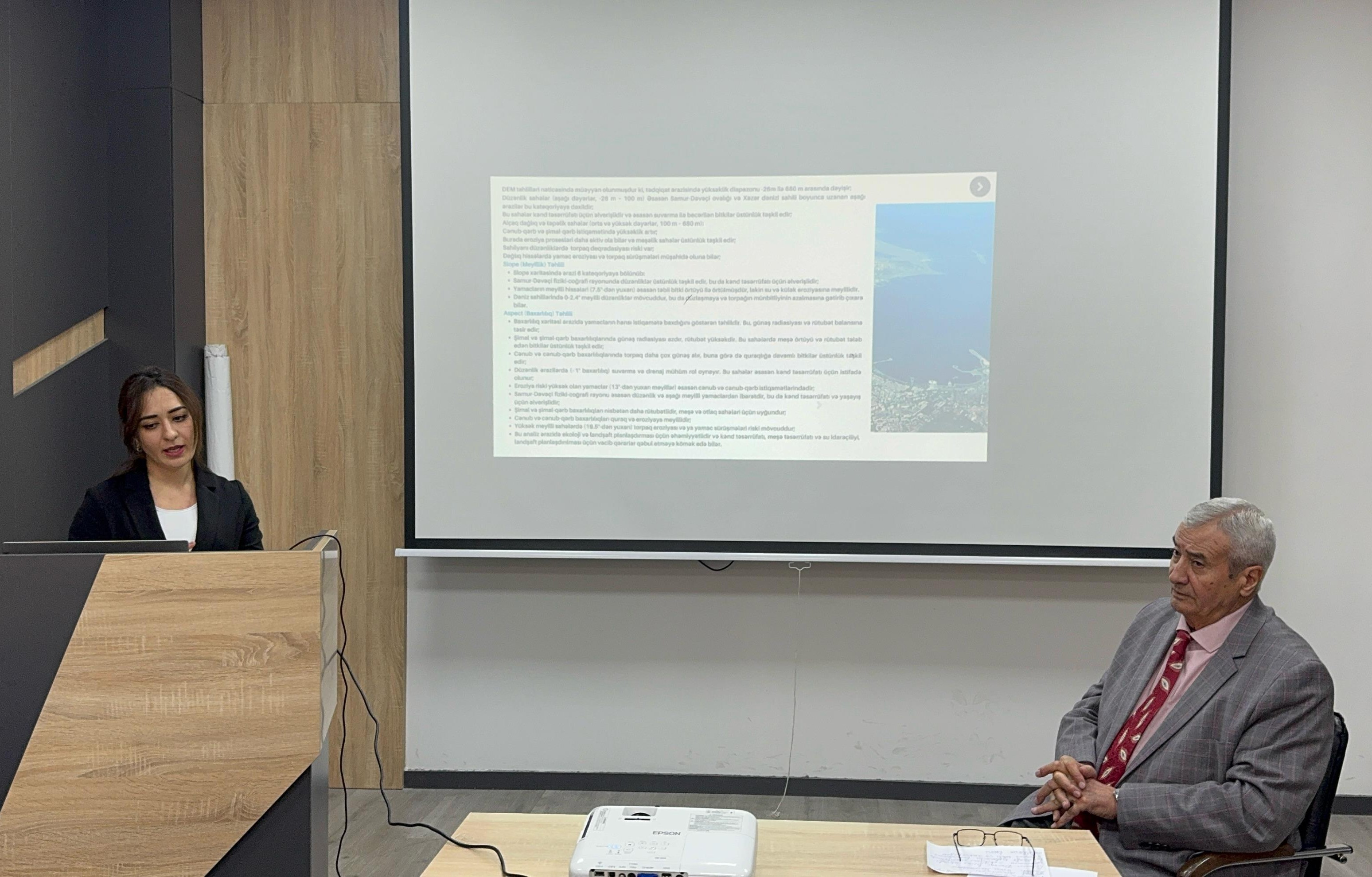
Gunay Abbasova, a doctoral student at the faculty, presented her findings at the seminar, which was held in honor of March 27 - Science Day. She emphasized the crucial role GIS plays in the scientific study of territories. The research focused on the Samur-Devechi coastal area, where various GIS methods, including Digital Elevation Model (DEM), Slope, and Aspect analysis, were applied. The study revealed that the elevation range in the area spans from 26 meters to 680 meters. Based on the slope map, the region was categorized into six distinct zones. The aspect map provided insights into the orientation of slopes, a key factor in landscape formation, as it affects the distribution of solar radiation and humidity.
GIS analysis of the area over the period 2017–2024 revealed that 1009 km² of the region was classified as a highly fragmented foothill arid forest-shrub landscape, 447.7 km² as moderately fragmented intermountain plains, and 896 km² as moderately and weakly fragmented intermountain plains and lowlands.
The seminar concluded with a lively discussion, where scientists and faculty members shared their insights and opinions on the presented report.